District de Winterthour

Cet article est une ébauche concernant la Suisse.
Vous pouvez partager vos connaissances en l’améliorant (comment ?) selon les recommandations des projets correspondants.
| District de Winterthour | ||||
 Héraldique | ||||
| Administration | ||||
|---|---|---|---|---|
| Pays |  Suisse Suisse | |||
| Canton |  Zurich Zurich | |||
| Chef-lieu | Winterthour | |||
| No OFS | B0110 | |||
| Démographie | ||||
| Population permanente | 176 811 hab. (2022[1]) | |||
| Densité | 702 hab./km2 | |||
| Géographie | ||||
| Coordonnées | 47° 30′ nord, 8° 46′ est | |||
| Superficie | 251,71 km2 | |||
| Subdivisions | ||||
| Communes | 19 | |||
| Localisation | ||||
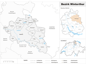 Carte de la subdivision. | ||||
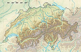
| Géolocalisation sur la carte : Suisse
Géolocalisation sur la carte : Suisse
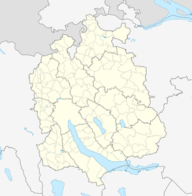
Géolocalisation sur la carte : canton de Zurich
| ||||
modifier  | ||||


Le district de Winterthour est un district du canton de Zurich en Suisse.
Communes
| Nom | N° OFS[2] | Population (décembre 2022)[1] |
|---|---|---|
| Altikon | 211 | |
| Brütten | 213 | |
| Dägerlen | 214 | |
| Dättlikon | 215 | |
| Dinhard | 216 | |
| Elgg | 294 | |
| Ellikon an der Thur | 218 | |
| Elsau | 219 | |
| Hagenbuch | 220 | |
| Hettlingen | 221 | |
| Neftenbach | 223 | |
| Pfungen | 224 | |
| Rickenbach | 225 | |
| Schlatt | 226 | |
| Seuzach | 227 | |
| Turbenthal | 228 | |
| Wiesendangen | 229 | |
| Winterthour | 230 | |
| Zell | 231 | |
| Total | ||
Notes et références
v · m | ||
|---|---|---|
 | ||
 Portail du canton de Zurich


