Lansdale

Cet article est une ébauche concernant la Pennsylvanie.

Vous pouvez partager vos connaissances en l’améliorant (comment ?) selon les recommandations des projets correspondants.

Borough of Lansdale
Lansdale
Administration
Pays Drapeau des États-Unis États-Unis
État Drapeau de la Pennsylvanie Pennsylvanie
Comté Montgomery
Maire George Andrew Szekely III
Démographie
Population 16 071 hab. (2000)
Densité 2 009 hab./km2
Géographie
Coordonnées 40° 14′ 31″ nord, 75° 17′ 03″ ouest
Superficie 800 ha = 8 km2
· dont terre km2 (100 %)
· dont eau km2 (0 %)
Localisation
Géolocalisation sur la carte : États-Unis
Voir sur la carte topographique des États-Unis
Borough of Lansdale
Géolocalisation sur la carte : États-Unis
Voir sur la carte administrative des États-Unis
Borough of Lansdale
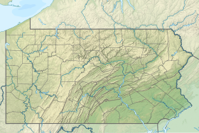
Géolocalisation sur la carte : Pennsylvanie
Voir sur la carte topographique de Pennsylvanie
Borough of Lansdale
Liens
Site web http://www.lansdale.org/
modifier 

Lansdale est un borough dans le Comté de Montgomery, en Pennsylvanie.

Notes et références

Cette section est vide, insuffisamment détaillée ou incomplète. Votre aide est la bienvenue ! Comment faire ?

Liens externes

  • Notices d'autoritéVoir et modifier les données sur Wikidata :
    • VIAF
    • LCCN
    • Israël
    • WorldCat
  • Ressource relative à la géographieVoir et modifier les données sur Wikidata :
    • Geographic Names Information System
Municipalités et communautés du comté de Montgomery (Pennsylvanie)
Siège du comté
  • Norristown
carte
carte
Boroughs
  • Ambler
  • Bridgeport
  • Bryn Athyn
  • Collegeville
  • Conshohocken
  • East Greenville
  • Green Lane
  • Hatboro
  • Hatfield
  • Jenkintown
  • Lansdale
  • Narberth
  • Norristown
  • North Wales
  • Pennsburg
  • Pottstown
  • Red Hill
  • Rockledge
  • Royersford
  • Schwenksville
  • Souderton
  • Telford‡
  • Trappe
  • West Conshohocken
Townships
Census-designated places
  • Arcadia University
  • Ardmore‡
  • Audubon
  • Blue Bell
  • Bryn Mawr
  • Eagleville
  • Evansburg
  • Flourtown
  • Fort Washington
  • Gilbertsville
  • Glenside
  • Halfway House
  • Harleysville
  • Haverford College‡
  • Horsham
  • King of Prussia
  • Kulpsville
  • Maple Glen
  • Montgomeryville
  • Oreland
  • Penn Wynne
  • Plymouth Meeting
  • Pottsgrove
  • Sanatoga
  • Skippack
  • Spring House
  • Spring Mount
  • Stowe
  • Trooper
  • Willow Grove
  • Woxall
  • Wyncote
  • Wyndmoor
Communautés non incorporées
  • Arcola
  • Ardsley
  • Ashmead Village
  • Bala Cynwyd
  • Barren Hill
  • Belmont Hills
  • Bethayres
  • Camp Hill
  • Cedarbrook
  • Cedars
  • Center Point
  • Center Square
  • Chapel‡
  • Colmar
  • Congo
  • Creamery
  • Crestmont
  • Cheltenham
  • Dresher
  • Earlington
  • Edge Hill
  • Elkins Park
  • Erdenheim
  • Eureka‡
  • Fairview Village
  • Fitzwatertown
  • Franconia
  • Frederick
  • Fulmor
  • Geryville‡
  • Gladwyne
  • Graterford
  • Gulph Mills
  • Gwynedd
  • Gwynedd Valley
  • Haverford‡
  • Hollywood
  • Huntingdon Valley
  • Jarrettown
  • Lafayette Hill
  • La Mott
  • Laverock
  • Layfield
  • Lederach
  • Line Lexington‡
  • Linfield
  • Mainland
  • McKinley
  • Meadowbrook
  • Melrose Park
  • Merion
  • Mingo
  • Miquon
  • Mont Clare
  • Montgomery Square
  • New Hanover Square
  • Noble
  • North Hills
  • Oaks
  • Obelisk
  • Palm
  • Penn Valley
  • Perkiomenville
  • Port Indian
  • Port Kennedy
  • Port Providence
  • Prospectville
  • Rahns
  • Rosemont‡
  • Roslyn
  • Roychester
  • Rydal
  • Salford
  • Salfordville
  • Sassamansville
  • Spring Mill
  • Sumneytown
  • Swedeland
  • Three Tuns
  • Tylersport
  • Unionville‡
  • Villanova‡
  • Wayne‡
  • West Point
  • Worcester
  • Wynnewood‡
  • Yerkes
  • Zieglerville
Note
  • ‡ Ces localités partagent du territoire dans plusieurs comtés adjacents.
  • icône décorative Portail de la Pennsylvanie