Le Pertuis
 Zie ook Pertuis, een andere Franse gemeente.
 Gemeente in Frankrijk  | |||
|---|---|---|---|
  | |||
| Situering | |||
| Regio | Auvergne-Rhône-Alpes | ||
| Departement | Haute-Loire (43) | ||
| Arrondissement | Le Puy-en-Velay | ||
| Kanton | Emblavez-et-Meygal | ||
| Coördinaten | 45° 6′ NB, 4° 3′ OL | ||
| Algemeen | |||
| Oppervlakte | 11,89 km² | ||
| Inwoners (1 januari 2021) | 508 (43 inw./km²) | ||
| Hoogte | 879 - 1255 m | ||
| Overig | |||
| Postcode | 43200 | ||
| INSEE-code | 43150 | ||
| Foto's | |||
 | |||
| Gemeentehuis | |||
| |||

Le Pertuis is een gemeente in het Franse departement Haute-Loire (regio Auvergne-Rhône-Alpes) en telt 375 inwoners (1999). De plaats maakt deel uit van het arrondissement Le Puy-en-Velay.
Geografie
De oppervlakte van Le Pertuis bedraagt 11,7 km², de bevolkingsdichtheid is 32,1 inwoners per km².
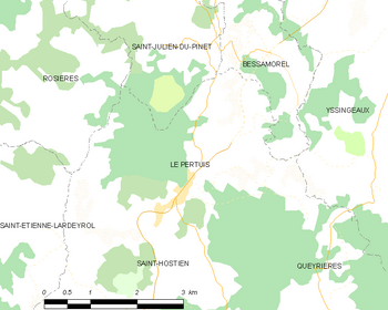
De onderstaande kaart toont de ligging van Le Pertuis met de belangrijkste infrastructuur en aangrenzende gemeenten.
 |
Demografie
Onderstaande figuur toont het verloop van het inwonertal (bron: INSEE-tellingen).

Externe links
- (fr) Statistische informatie op de website van INSEE
Bronnen, noten en/of referenties
Mediabestanden
Zie de categorie Le Pertuis van Wikimedia Commons voor mediabestanden over dit onderwerp.


