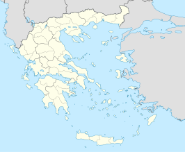
Loutrochori
Plaats in Griekenland  | |||
|---|---|---|---|
  | |||
| Situering | |||
| Periferie | Centraal-Macedonië | ||
| Gemeente | Skydra | ||
| Coördinaten | 40° 43′ NB, 22° 6′ OL | ||
| Algemeen | |||
| Oppervlakte | 7,506 km² | ||
| Inwoners (2001) | 466 | ||
| Overig | |||
| Postcode | 585 00 | ||
| |||
Loutrochori of Bania (Grieks: Λουτροχώρι of Μπάνια; Pontisch: Λουτροχώρ) is een dorp in de deelgemeente (dimotiki enotita) Skydra[1] van de fusiegemeente (dimos) Skydra, in de Griekse bestuurlijke regio (periferia) Centraal-Macedonië.
Geografie
Loutrochori heeft een oppervlakte van 7,506 km² en ligt in de regio Macedonië (77 km noordwesten Thessaloniki) in Noord-Griekenland. Het dorp telt ongeveer 466 inwoners en ligt tussen de regio's Pella en Imathia.
Geschiedenis
Loutrochori heeft een rijke geschiedenis. De meeste inwoners zijn vluchtelingen uit Pontus in het noorden van Anatolië en het Pontisch (een oud Grieks dialect) is hun eerste taal.
Historische populatie

| Bevolkingsontwikkeling (Statistiek, 1912/13 - 2001 en 2007) | |||||||
| Jaar | Bevolkingsaantal | +/- | % | Bevolkingsdichtheid | |||
|---|---|---|---|---|---|---|---|
| 1912/13 | --- | --- | --- | --- | |||
| 1920 | --- | --- | --- | --- | |||
| 1928 | 115 | --- | --- | 15 /km² | |||
| 1940 | --- | --- | --- | --- | |||
| 1951[2] | 367 | --- | --- | 49 /km² | |||
| 1961[2] | 435 | + 68 | + 18.53% | 58 /km² | |||
| 1971[2] | 391 | - 44 | - 10.12% | 52 /km² | |||
| 1981[2] | 772 | + 381 | + 97.44% | 103 /km² | |||
| 1991[2] | 483 | - 289 | - 37.43% | 64 /km² | |||
| 2001[2] | 466 | - 17 | - 3.52% | 62 /km² | |||
| 2007 (est.) | 445 * | - 21 | - 4.51 % | 59 /km² | |||
| * Grieken: Macedoniërs i Pontiërs. | |||||||
Klimaat
Loutrochori heeft een mediterraan klimaat. Dat betekent lange zomers en milde winters.
| Weer in Loutrochori | ||||||||||||||
| Maand | Jan | Feb | Mar | Apr | Mei | Jun | Jul | Aug | Sep | Okt | Nov | Dec | Jaar | |
|---|---|---|---|---|---|---|---|---|---|---|---|---|---|---|
| Maximumtemperatuur °C (°F) | 7 (44) | 9 (48) | 14 (57) | 18 (64) | 24 (75) | 29 (84) | 31 (88) | 32 (90) | 27 (81) | 22 (71) | 14 (55) | 8 (46) | 19,5 (67) | |
| Minimumtemperatuur °C (°F) | 1 (34) | 3 (37) | 6 (43) | 8 (47) | 12 (54) | 17 (62) | 19 (66) | 18 (64) | 15 (59) | 12 (54) | 6 (43) | 3 (37) | 10 (50) | |
| Regen (mm) | 43 | 51 | 45 | 35 | 41 | 28 | 27 | 23 | 34 | 39 | 51 | 53 | 470 (39,2 / maand) | |
| Record temperatuur °C (°F) | 19 (66) | 22 (72) | 26 (79) | 32 (90) | 38 (100) | 40 (104) | 41 (106) | 42 (108) | 34 (93) | 31 (88) | 25 (77) | 22 (72) | 31 (88) | |
| Source: Fallingrain, Freemeteo en Multimap | ||||||||||||||
Externe links
- Loutrochori on GTP Travel Pages (Community)
- Loutrochórion (Pélla, Macedonia, Greece)
- Map of Central Macedonia. - Loutrochori NW (20)
- (el) Primary school of Loutrochori
- (el) Kindergarten of Loutrochori
- (el) Loutrochori (epigraphy, Delacoulonche 242,24)
- (el) History and Information about the baths of Loutrochori
- ↑ (el) Bestuurlijke indeling vanaf 2011 en aantal inwoners in 2001 (p. 17378 ΔΗΜΟΤΙΚΗ ΕΝΟΤΗΤΑ ΣΚΥΔΡΑΣ)
- ↑ a b c d e f Census 1951-2001 (Grieks). Dimos Skydras (Δήμος Σκύδρας). www.skydra.gr.


