Hrabstwo Sumner (Tennessee)
| hrabstwo | |||
 | |||
| Państwo |
| ||
|---|---|---|---|
| Stan |
| ||
| Siedziba | Gallatin | ||
| Kod statystyczny | FIPS 6-4: 47165 | ||
| Powierzchnia | 1406,67 km²[1] | ||
| Populacja (2009) • liczba ludności |
| ||
Położenie na mapie Tennessee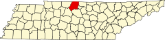 | |||
| 36°28′12″N 86°27′36″W/36,470000 -86,460000 | |||
| |||
| Strona internetowa | |||


Hrabstwo Sumner (ang. Sumner County) – hrabstwo w stanie Tennessee w Stanach Zjednoczonych. Obszar całkowity hrabstwa obejmuje powierzchnię 543,12 mil² (1406,67 km²). Według szacunków United States Census Bureau w roku 2009 miało 158 759 mieszkańców[2].
Hrabstwo powstało w 1786 roku[3].
Miasta
- Gallatin
- Goodlettsville
- Hendersonville
- Millersville
- Mitchellville
- Portland
- Westmoreland[4]
CDP
- Bethpage
- Bransford
- Castalian Springs
- Cottontown
- Fairfield
- Graball
- New Deal
- Oak Grove
- Shackle Island
- Walnut Grove[4]
| Populacja hrabstwa w poprzednich latach[3] | |
|---|---|
| Rok | Liczba ludności |
| 1980 | 84 643 |
| 1990 | 103 281 |
| 2000 | 130 449 |
| 2005 | 145 009 |
Przypisy
- ↑ US Census Bureau: Population, Housing Units, Area, and Density: 2010. [dostęp 2012-10-05]. [zarchiwizowane z tego adresu (2015-07-08)]. (ang.).
- ↑ a b US Census Bureau: Sumner County. Quickfacts. [dostęp 2011-03-06]. (ang.).
- ↑ a b National Association of Counties: Sumner County, TN. [dostęp 2011-03-06]. (ang.).
- ↑ a b National Association of Counties: Places in Sumner County, TN. [dostęp 2011-03-06]. (ang.).
- p
- d
- e
|

Kontrola autorytatywna (hrabstwo w stanie Tennessee):


