Smithtown (Nova Iorque)
Smithtown

| País |  Estados Unidos Estados Unidos |
|---|---|
| Estado | Nova Iorque |
| County of New York | Condado de Suffolk |
| Área | 288,52 km2 |
| Altitude | 32 m |
| Coordenadas | 40° 51′ 46″ N, 73° 12′ 55″ O  |
| População | 116 296 hab. () |
|---|---|
| Densidade | 403,1 hab./km2 () |
| Estatuto | vila dos Estados Unidos (en) town of New York (d) |
|---|
| Origem do nome | Richard Smith (d) |
|---|---|
| Fundador | Richard Smith (d) |
| Code FIPS | 36-68000 |
|---|---|
| GNIS | 979498 |
| Prefixo telefônico | 631 |
| Website | (en) www.smithtowninfo.com |

editar - editar código-fonte - editar Wikidata
Smithtown é uma vila no Condado de Suffolk, Nova Iorque, Estados Unidos, na costa norte de Long Island. A população era de 115 715 no censo de 2000. [1]
História
A cidade foi fundada por volta de 1665. Uma lenda local conta que depois de resgatar a filha sequestrada do chefe nativo americano, Richard Smith receberia do chefe toda a terra que ele conseguiria circundar num dia, e montado num touro. Smith escolheu montar o touro no dia mais longo do ano (solstício de verão) - para conseguir mais "em um dia". O terreno que ele conseguiu desta forma seria a localização aproximada da atual cidade. Existe uma estátua anatomicamente certa do touro, conhecido como Whisper, na bifurcação de Jericó Turnpike (Estrada Estadual 25 de Nova Iorque) e Johnland St. Road (Estrada Estadual 25A de Nova Iorque). Smithtown era originalmente conhecida como "Smithfield".
A fronteira entre Smithtown e a cidade de Huntington é parcialmente definida pelo estrada Bread and Cheese Hollow (Suffolk County Road 4), assim chamada por, segundo a lenda, ter sido onde Smith parou para um almoço de pão (em inglês bread) e queijo (em inglês cheese).
Geografia
A cidade de Smithtown está localizada a 40 ° 52 '13 "Norte, 73 ° 13' 3" Oeste (40,862786, -73,215175).
De acordo com o United States Census Bureau tem uma área total de 111,4 milhas quadradas (288,5 km²), dos quais, 53,6 quilômetros quadrados (138,8 km ²) de terreno e 57,8 km ² (149,7 km ²) da mesma (51,89%) é água.
Referências
- ↑ «2016 U.S. Gazetteer Files». United States Census Bureau. Consultado em Jul 5, 2017
Ligações externas
- Smithtown Central School District Website
- Town of Smithtown, NY
- Smithtown history
- Bullrider Smith's Bull "Whisper" Cortesia Maggiblanck.com
- Kings Park Heritage Museum
- Kings Park Chamber of Commerce
- Bygone Long Island
O Commons possui imagens e outros ficheiros sobre Smithtown (Nova Iorque)
O Commons possui uma categoria com imagens e outros ficheiros sobre Smithtown (Nova Iorque)
Localidades do condado de Suffolk, Nova Iorque (estado) | ||
|---|---|---|
Sede do condado: Riverhead | ||
| Vilas | Babylon | Brookhaven | East Hampton | Huntington | Islip | Riverhead | Shelter Island | Smithtown | Southampton | Southold | 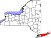 |
| Aldeias | Amityville | Asharoken | Babylon | Belle Terre | Bellport | Dering Harbor | East Hampton | Greenport | Head of the Harbor | Huntington Bay | Lake Grove | Lindenhurst | Lloyd Harbor | Mastic Beach | Nissequogue | North Haven | Northport | Old Field | Patchogue | Poquott | Port Jefferson | Quogue | Sag Harbor | Sagaponack | Shoreham | Southampton | Village of the Branch | Westhampton Beach | West Hampton Dunes | |
| Regiões censodesignadas | Amagansett | Aquebogue | Baiting Hollow | Blue Point | Bridgehampton | Brookhaven | Calverton | Center Moriches | Centereach | Centerport | Cold Spring Harbor | Commack | Copiague | Coram | Cutchogue | Deer Park | Dix Hills | East Farmingdale | East Hampton North | East Marion | East Moriches | East Northport | East Patchogue | East Quogue | East Shoreham | Eastport | Eatons Neck | Elwood | Farmingville | Flanders | Fort Salonga | Gilgo-Oak Beach-Captree | Gordon Heights | Greenlawn | Greenport West | Halesite | Hampton Bays | Holbrook | Holtsville | Huntington | Huntington Station | Ilha Fishers | Jamesport | Kings Park | Lake Ronkonkoma | Laurel | Manorville | Mastic | Mattituck | Medford | Melville | Middle Island | Miller Place | Montauk | Moriches | Mount Sinai | Napeague | Nesconset | New Suffolk | North Amityville | North Babylon | North Bellport | North Lindenhurst | North Patchogue | North Sea | Northampton | Northville | Northwest Harbor | Noyack | Orient | Peconic | Port Jefferson Station | Quioque | Remsenburg-Speonk | Ridge | Riverhead | Riverside | Rocky Point | Ronkonkoma | Selden | Setauket-East Setauket | Shelter Island | Shelter Island Heights | Shinnecock Hills | Shirley | Smithtown | Sound Beach | South Huntington | Southold | Springs | St. James | Stony Brook | Terryville | Tuckahoe | Wading River | Wainscott | Water Mill | West Babylon | West Hills | Westhampton | Wheatley Heights | Wyandanch | Yaphank | |
| Other hamlets | Canaan Lake | Cherry Grove | Crystal Brook | Cupsogue Beach | Davis Park | Fire Island Pines | Hagerman | Ocean Bay Park | Point O' Woods | Remsenburg | South Haven | Speonk | Strongs Neck | Upton | Water Island | West Manor | | |
| Reservas indígenas | Poospatuck | Shinnecock Reservation | |
 Nova Iorque Nova Iorque | ||
|---|---|---|
Capital: Albany | ||
| Tópicos |
|  |
| Principais cidades |
| |
| Outras cidades e vilas |
| |
| Condados |
| |
 Portal Portal | ||
 | Este artigo sobre geografia dos Estados Unidos é um esboço. Você pode ajudar a Wikipédia expandindo-o.
|
 Portal da geografia
 Portal de Nova Iorque
 Portal dos Estados Unidos


