Beeston and Stapleford
| Beeston and Stapleford | |
 Beeston | |
| Land |  Storbritannien Storbritannien |
|---|---|
| Riksdel | England |
| Region | East Midlands |
| Ceremoniellt grevskap | Nottinghamshire |
| Administrativt grevskap | Nottinghamshire |
| Distrikt | Broxtowe |
| Koordinater | 52°55′33″N 1°12′58″V / 52.9257°N 1.2161°V / 52.9257; -1.2161 |
| Tidszon | UTC (UTC+0) |
| - sommartid | BST (UTC+1) |
  Läge i Storbritannien | |
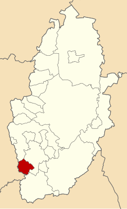 | |

Beeston and Stapleford var en civil parish från 1935[1] till 1974,[2] i grevskapet Nottinghamshire, i England. Civil parish var belägen 6 km från Nottingham och hade 55 995 invånare år 1961.[3] Beeston and Stapleford var ett distrikt från 1935 till 1974[4] då den blev en del av Broxtowe.[5]
Referenser
- ^ ”Relationships and changes Beeston and Stapleford CP through time”. A Vision of Britain through Time. https://visionofbritain.org.uk/unit/10256689. Läst 28 maj 2024.
- ^ ”Basford Registration District”. UKBMD. https://www.ukbmd.org.uk/reg/districts/basford.html. Läst 28 maj 2024.
- ^ ”Population statistics Beeston and Stapleford CP through time”. A Vision of Britain through Time. https://visionofbritain.org.uk/unit/10256689/cube/TOT_POP. Läst 28 maj 2024.
- ^ ”Relationships and changes Beeston and Stapleford UD through time”. A Vision of Britain through Time. https://visionofbritain.org.uk/unit/10492282. Läst 28 maj 2024.
- ^ ”The English Non-metropolitan Districts (Definition) Order 1972”. legislation.gov.uk. https://www.legislation.gov.uk/uksi/1972/2039/schedule/part/30/made. Läst 28 maj 2024.
Externa länkar
 Wikimedia Commons har media som rör Beeston and Stapleford.


