Custer, South Dakota
| Custer | |
| city | |
 Main Street | |
| Land |  USA USA |
|---|---|
| Delstat | South Dakota |
| County | Custer County |
| Höjdläge | 1 620 m ö.h. |
| Koordinater | 43°46′0″N 103°35′56″V / 43.76667°N 103.59889°V / 43.76667; -103.59889 |
| Yta | 6,58 km² (2010) |
| - land | 6,55 km² |
| - vatten | 0,03 km² |
| Folkmängd | 2 067 (2010) |
| Befolkningstäthet | 316 invånare/km² |
| Tidszon | MST (UTC-7) |
| - sommartid | MDT (UTC-6) |
| ZIP-kod | 57730 |
| Riktnummer | 605 |
| FIPS | 4615140 |
| Geonames | 5763910 |
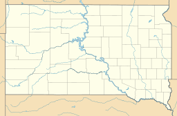  Ortens läge i South Dakota | |
 South Dakotas läge i USA | |
| Webbplats: http://www.custer.govoffice.com/ | |
Custer är administrativ huvudort i Custer County i South Dakota.[1] Orten har fått sitt namn efter militären George Armstrong Custer.[2] Enligt 2010 års folkräkning hade Custer 2 067 invånare.[3]
Källor
- ^ South Dakota County Map with County Seat Cities. Geology.com Geoscience News and Information. Läst 14 december 2016.
- ^ Profile for Custer, South Dakota. ePodunk. Läst 14 december 2016.
- ^ 2010 Census Population of Custer, South Dakota Arkiverad 20 december 2016 hämtat från the Wayback Machine.. Census Viewer. Läst 14 december 2016.
Bilder & media
|


