San Bernardo, Nariño
Municipality and town in Nariño Department, Colombia

Flag
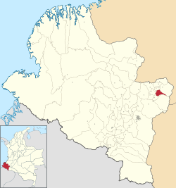
Location of the municipality and town of San Bernardo, Nariño in the Nariño Department of Colombia.
 Colombia
 (Census 2018[1])
San Bernardo (Spanish pronunciation: [sam beɾˈnaɾðo]) is a town and municipality in the Nariño Department, Colombia.
Climate
San Bernando has a warm subtropical highland climate (Köppen Cfb) with moderate to heavy rainfall year-round. Like most of Andean Nariño Department but unlike most places with a subtropical highland climate, San Bernando has a marked summer minimum in rainfall instead of the more usual winter minimum.
| Climate data for San Bernardo, elevation 2,190 m (7,190 ft), (1981–2010) | |||||||||||||
|---|---|---|---|---|---|---|---|---|---|---|---|---|---|
| Month | Jan | Feb | Mar | Apr | May | Jun | Jul | Aug | Sep | Oct | Nov | Dec | Year |
| Mean daily maximum °C (°F) | 21.2 (70.2) | 21.4 (70.5) | 21.4 (70.5) | 21.8 (71.2) | 21.6 (70.9) | 21.5 (70.7) | 21.1 (70.0) | 21.4 (70.5) | 22.1 (71.8) | 21.7 (71.1) | 20.9 (69.6) | 20.9 (69.6) | 21.4 (70.5) |
| Daily mean °C (°F) | 15.6 (60.1) | 15.9 (60.6) | 15.9 (60.6) | 16.0 (60.8) | 16.0 (60.8) | 15.7 (60.3) | 15.4 (59.7) | 15.5 (59.9) | 15.8 (60.4) | 15.7 (60.3) | 15.5 (59.9) | 15.5 (59.9) | 15.7 (60.3) |
| Mean daily minimum °C (°F) | 11.4 (52.5) | 11.4 (52.5) | 11.7 (53.1) | 11.9 (53.4) | 11.9 (53.4) | 11.2 (52.2) | 10.5 (50.9) | 10.4 (50.7) | 10.5 (50.9) | 11.2 (52.2) | 11.7 (53.1) | 11.6 (52.9) | 11.3 (52.3) |
| Average precipitation mm (inches) | 220.4 (8.68) | 175.7 (6.92) | 206.6 (8.13) | 217.2 (8.55) | 169.6 (6.68) | 74.7 (2.94) | 54.8 (2.16) | 40.7 (1.60) | 81.5 (3.21) | 240.8 (9.48) | 311.5 (12.26) | 247.4 (9.74) | 2,041 (80.35) |
| Average precipitation days | 19 | 17 | 20 | 20 | 20 | 15 | 14 | 12 | 12 | 19 | 23 | 22 | 211 |
| Average relative humidity (%) | 85 | 85 | 85 | 85 | 84 | 82 | 79 | 78 | 77 | 83 | 86 | 87 | 83 |
| Mean monthly sunshine hours | 124.0 | 101.6 | 96.1 | 102.0 | 117.8 | 138.0 | 161.2 | 164.3 | 135.0 | 120.9 | 102.0 | 111.6 | 1,474.5 |
| Mean daily sunshine hours | 4.0 | 3.6 | 3.1 | 3.4 | 3.8 | 4.6 | 5.2 | 5.3 | 4.5 | 3.9 | 3.4 | 3.6 | 4.0 |
| Source: Instituto de Hidrologia Meteorologia y Estudios Ambientales[2] | |||||||||||||
References
- v
- t
- e
Municipalities in the Nariño Department
- Albán
- Aldana
- Ancuya
- Arboleda
- Barbacoas
- Belén
- Buesaco
- Chachagüí
- Colón (Génova)
- Consaca
- Contadero
- Córdoba
- Cuaspud
- Cumbal
- Cumbitara
- El Charco
- El Peñol
- El Rosario
- El Tablón
- El Tambo
- Francisco Pizarro
- Funes
- Guachucal
- Guaitarilla
- Gualmatán
- Iles
- Imués
- Ipiales
- La Cruz
- La Florida
- La Llanada
- La Tola
- La Unión
- Leiva
- Linares
- Los Andes
- Magüí Payán
- Mallama
- Mosquera
- Nariño
- Olaya Herrera
- Ospina
- Pasto
- Policarpa
- Potosí
- Providencia
- Puerres
- Pupiales
- Ricaurte
- Roberto Payán
- Samaniego
- San Bernardo
- Sandona
- San Lorenzo
- San Pablo
- San Pedro de Cartago
- Santa Barbara
- Santacruz
- Sapuyes
- Taminango
- Tangua
- Tumaco
- Tuquerres
- Yacuanquer

1°30′39″N 77°2′48″W / 1.51083°N 77.04667°W / 1.51083; -77.04667
 | This Department of Nariño location article is a stub. You can help Wikipedia by expanding it. |
- v
- t
- e


