Zantman's Rock
49°54′02″N 6°27′07″W / 49.9006°N 6.4519°W / 49.9006; -6.4519
United Kingdom
Zantman's Rock near left margin
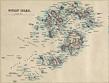
Zantman's Rock is located 34 miles (55 km) to the west of Land's End, Cornwall, and 6 miles (9.7 km) west from the Isles of Scilly. Viewed from a distance, it is barely visible on the surface of the waters. It is 2 miles (3.2 km) north of Bishop Rock Lighthouse, and about 0.25 miles (0.40 km) northeast of the Crim Rocks.
The name "Zantman's Rock" is recorded on an Admiralty chart of 1860: before then, it appears not to have been distinguished from the Crim Rocks a short distance to the southwest.[1] Several legends attempt to explain the name of the rock, one of which involves a Dutchman being shipwrecked and finding himself in the unlikely position of clinging on to the rock.[1]
Zantman's Rock has been the cause of at least one famous shipwreck: that of the Susanna, on 14 August 1913. The wreckage still lies on the southwestern side of Zantman's Rock.
See also
 Cornwall portal

References
- ^ a b Dixe Wills, (2005), The Z-Z of Great Britain, page 35. Icon. ISBN 1-84046-754-1
- v
- t
- e
Isles of Scilly
- St Mary's
- St Agnes (and Gugh)
- Bryher
- Tresco
- St Martin's
- St Mary's: Hugh Town, Holy Vale, Longstone, Maypole, Normandy, Old Town, Pelistry, Porthloo, Rocky Hill, Telegraph and Trenoweth
- St Martin's: Higher Town, Middle Town and Lower Town
- St Agnes: Middle Town
- Tresco: New Grimsby and Old Grimsby
- Environment
- History
- People
- Transport
 | This article about a location in the Isles of Scilly, Cornwall is a stub. You can help Wikipedia by expanding it. |
- v
- t
- e


