National Register of Historic Places listings in Allen Parish, Louisiana

This is a list of the National Register of Historic Places listings in Allen Parish, Louisiana.
This is intended to be a complete list of the properties on the National Register of Historic Places in Allen Parish, Louisiana, United States. The locations of National Register properties for which the latitude and longitude coordinates are included below, may be seen in a map.[1]
There are 4 properties listed on the National Register in the parish.
This National Park Service list is complete through NPS recent listings posted July 12, 2024.[2]
Map all coordinates using OpenStreetMap
Download coordinates as:
- KML
- GPX (all coordinates)
- GPX (primary coordinates)
- GPX (secondary coordinates)
Current listings
| [3] | Name on the Register | Image | Date listed[4] | Location | City or town | Description |
|---|---|---|---|---|---|---|
| 1 | Allen Parish Courthouse |  | June 3, 1981 (#81000287) | Head of 6th Avenue 30°37′13″N 92°46′05″W / 30.62041°N 92.76807°W / 30.62041; -92.76807 (Allen Parish Courthouse) | Oberlin | |
| 2 | Elizabeth Hospital Building |  | January 18, 1985 (#85000092) | 230 Poplar Street 30°51′54″N 92°47′44″W / 30.8649°N 92.79551°W / 30.8649; -92.79551 (Elizabeth Hospital Building) | Elizabeth | Now serves as Elizabeth Town Hall. |
| 3 | Genius Brothers Building |  | June 27, 1990 (#90000909) | Corner of 8th Street and 4th Avenue 30°29′14″N 92°51′01″W / 30.48728°N 92.85039°W / 30.48728; -92.85039 (Genius Brothers Building) | Kinder | |
| 4 | St. Paul Baptist Church-Morehead School |  | July 6, 2005 (#05000686) | 772 Hickory Flats Road 30°32′57″N 92°49′26″W / 30.54904°N 92.82399°W / 30.54904; -92.82399 (St. Paul Baptist Church-Morehead School) | Kinder vicinity |
See also
Wikimedia Commons has media related to National Register of Historic Places in Allen Parish, Louisiana.
- List of National Historic Landmarks in Louisiana
- National Register of Historic Places listings in Louisiana
References
- ^ The latitude and longitude information provided in this table was derived originally from the National Register Information System, which has been found to be fairly accurate for about 99% of listings. Some locations in this table may have been corrected to current GPS standards.
- ^ National Park Service, United States Department of the Interior, "National Register of Historic Places: Weekly List Actions", retrieved July 12, 2024.
- ^ Numbers represent an alphabetical ordering by significant words. Various colorings, defined here, differentiate National Historic Landmarks and historic districts from other NRHP buildings, structures, sites or objects.
- ^ The eight-digit number below each date is the number assigned to each location in the National Register Information System database, which can be viewed by clicking the number.
- v
- t
- e
by parish
- Acadia
- Allen
- Ascension
- Assumption
- Avoyelles
- Beauregard
- Bienville
- Bossier
- Caddo
- Calcasieu
- Caldwell
- Cameron
- Catahoula
- Claiborne
- Concordia
- DeSoto
- East Baton Rouge
- East Carroll
- East Feliciana
- Evangeline
- Franklin
- Grant
- Iberia
- Iberville
- Jackson
- Jefferson
- Jefferson Davis
- La Salle
- Lafayette
- Lafourche
- Lincoln
- Livingston
- Madison
- Morehouse
- Natchitoches
- Orleans
- Ouachita
- Plaquemines
- Pointe Coupee
- Rapides
- Red River
- Richland
- Sabine
- St. Bernard
- St. Charles
- St. Helena
- St. James
- St. John the Baptist
- St. Landry
- St. Martin
- St. Mary
- St. Tammany
- Tangipahoa
- Tensas
- Terrebonne
- Union
- Vermilion
- Vernon
- Washington
- Webster
- West Baton Rouge
- West Carroll
- West Feliciana
- Winn

Municipalities and communities of Allen Parish, Louisiana, United States | ||
|---|---|---|
Parish seat: Oberlin | ||
| City | 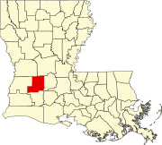 | |
| Towns | ||
| Villages | ||
| Unincorporated communities | ||
| Indian reservation | ||
| Footnotes | ‡This populated place also has portions in an adjacent county or counties | |
| ||


