National Register of Historic Places listings in Jackson County, Oregon
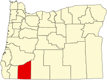
This list presents the full set of buildings, structures, objects, sites, or districts designated on the National Register of Historic Places in Jackson County, Oregon, and offers brief descriptive information about each of them. The National Register recognizes places of national, state, or local historic significance across the United States.[1] Out of over 90,000 National Register sites nationwide,[2] Oregon is home to over 2,000,[3] and 154 of those are found in Jackson County.
This National Park Service list is complete through NPS recent listings posted August 16, 2024.[4]
Current listings
| [5] | Name on the Register | Image | Date listed[6] | Location | City or town | Description |
|---|---|---|---|---|---|---|
| 1 | Nils Ahlstrom House |  | February 15, 1980 (#80003315) | 248 5th St. 42°11′50″N 122°42′21″W / 42.19717778°N 122.7058389°W / 42.19717778; -122.7058389 (Nils Ahlstrom House) | Ashland | |
| 2 | Thomas N. Anderson House |  | June 1, 1990 (#90000845) | 719 Second Ave. 42°25′56″N 123°03′06″W / 42.432222°N 123.051667°W / 42.432222; -123.051667 (Thomas N. Anderson House) | Gold Hill | |
| 3 | Antelope Creek Covered Bridge |  | December 26, 2012 (#12001091) | Little Butte Creek, 35 feet (11 m) east of Main Street 42°28′20″N 122°48′01″W / 42.472126°N 122.800225°W / 42.472126; -122.800225 (Antelope Creek Covered Bridge) | Eagle Point | |
| 4 | Ashland Cemetery |  | June 8, 1995 (#95000687) | Junction of E. Main and Morton Sts. 42°11′37″N 122°42′18″W / 42.19366111°N 122.7050056°W / 42.19366111; -122.7050056 (Ashland Cemetery) | Ashland | |
| 5 | Ashland Depot Hotel, South Wing |  | February 19, 1991 (#91000047) | 624 A St. 42°11′52″N 122°42′20″W / 42.19775833°N 122.7056583°W / 42.19775833; -122.7056583 (Ashland Depot Hotel, South Wing) | Ashland | |
| 6 | Ashland Downtown Historic District |  | May 5, 2000 (#00000446) | Roughly bounded by Lithia Way/C St., Church, Lithia Park/Hargadine, and Gresham Sts. 42°11′46″N 122°42′47″W / 42.196245°N 122.713096°W / 42.196245; -122.713096 (Ashland Downtown Historic District) | Ashland | |
| 7 | Ashland Masonic Lodge Building |  | June 4, 1992 (#92000663) | 25 N. Main St. 42°11′49″N 122°42′57″W / 42.197063°N 122.715800°W / 42.197063; -122.715800 (Ashland Masonic Lodge Building) | Ashland | |
| 8 | Ashland Municipal Powerhouse |  | September 10, 1987 (#87001563) | Ashland Creek Canyon 42°10′09″N 122°42′46″W / 42.169167°N 122.712778°W / 42.169167; -122.712778 (Ashland Municipal Powerhouse) | Ashland | |
| 9 | Ashland Oregon National Guard Armory |  | September 10, 1987 (#87001564) | 208 Oak St. 42°11′55″N 122°42′48″W / 42.19865278°N 122.7132611°W / 42.19865278; -122.7132611 (Ashland Oregon National Guard Armory) | Ashland | |
| 10 | Ashland Railroad Addition Historic District |  | May 5, 1999 (#99000533) | Roughly bounded by Lithia Way, East Main, Oak St., A St. and 8th Sts. 42°11′48″N 122°42′22″W / 42.196667°N 122.706111°W / 42.196667; -122.706111 (Ashland Railroad Addition Historic District) | Ashland | |
| 11 | W. H. Atkinson House |  | October 16, 1979 (#79002063) | 125 N. Main St. 42°11′57″N 122°43′02″W / 42.199184°N 122.717131°W / 42.199184; -122.717131 (W. H. Atkinson House) | Ashland | |
| 12 | Sophenia Ish Baker House |  | September 9, 1993 (#93000924) | 902 W. McAndrews Rd. 42°19′52″N 122°53′35″W / 42.331228°N 122.893047°W / 42.331228; -122.893047 (Sophenia Ish Baker House) | Medford | |
| 13 | Barclay–Klum House |  | June 1, 1990 (#90000835) | 1023 E. Main St. 42°11′39″N 122°42′04″W / 42.19417222°N 122.7012444°W / 42.19417222; -122.7012444 (Barclay–Klum House) | Ashland | |
| 14 | Barnum Hotel |  | March 22, 1984 (#84003009) | 204 N. Front St. 42°19′41″N 122°52′28″W / 42.32799444°N 122.8744778°W / 42.32799444; -122.8744778 (Barnum Hotel) | Medford | |
| 15 | Baldwin Beach House |  | March 28, 1979 (#79002064) | 348 Hargadine St. 42°11′39″N 122°42′41″W / 42.194165°N 122.711479°W / 42.194165; -122.711479 (Baldwin Beach House) | Ashland | |
| 16 | Robert Vinton Beall House |  | October 18, 1979 (#79002069) | 1253 Beall Lane 42°21′44″N 122°54′36″W / 42.362291°N 122.909953°W / 42.362291; -122.909953 (Robert Vinton Beall House) | Central Point | |
| 17 | Beeson–Foss Ranch |  | January 27, 1999 (#99000067) | 6371 Wagner Creek Rd. 42°14′00″N 122°47′30″W / 42.233333°N 122.791667°W / 42.233333; -122.791667 (Beeson–Foss Ranch) | Talent | |
| 18 | Big Elk Guard Station |  | December 29, 2000 (#00000462) | FS Rd. 3706 approximately 5 miles (8.0 km) north of Dead Indian Memorial Rd. 42°21′32″N 122°21′28″W / 42.359021°N 122.357824°W / 42.359021; -122.357824 (Big Elk Guard Station) | Ashland vicinity | |
| 19 | Boslough–Claycomb House |  | December 9, 1981 (#81000486) | 1 Hillcrest St. 42°11′36″N 122°42′46″W / 42.193352°N 122.712691°W / 42.193352; -122.712691 (Boslough–Claycomb House) | Ashland | |
| 20 | Walter Bowne House |  | February 23, 1990 (#90000279) | 1845 Old Stage Rd. 42°20′35″N 122°57′11″W / 42.343067°N 122.952938°W / 42.343067; -122.952938 (Walter Bowne House) | Jacksonville | |
| 21 | BPOE Lodge No. 1168 |  | November 28, 1980 (#80003323) | 202 N. Central Ave. 42°19′43″N 122°52′25″W / 42.32853611°N 122.8736889°W / 42.32853611; -122.8736889 (BPOE Lodge No. 1168) | Medford | |
| 22 | Britt Gardens Site 35JA789 | Upload image | March 6, 2020 (#100005020) | Address restricted[7] | Jacksonville vicinity | |
| 23 | Buckhorn Mineral Springs Resort | Upload image | March 3, 1989 (#89000064) | 2200 Buckhorn Springs Rd. 42°06′20″N 122°31′46″W / 42.105556°N 122.529444°W / 42.105556; -122.529444 (Buckhorn Mineral Springs Resort) | Ashland | |
| 24 | Victor and Bertha Bursell House |  | April 29, 1982 (#82003725) | 3075 Hanley Rd. 42°21′39″N 122°55′49″W / 42.36086111°N 122.9302417°W / 42.36086111; -122.9302417 (Victor and Bertha Bursell House) | Central Point | |
| 25 | Butte Falls Ranger Station |  | April 11, 1986 (#86000824) | Rogue River National Forest 42°32′26″N 122°33′53″W / 42.540539°N 122.564779°W / 42.540539; -122.564779 (Butte Falls Ranger Station) | Butte Falls | |
| 26 | Frank E. Bybee House |  | December 9, 1981 (#81000492) | 4491 Jacksonville Hwy. 42°19′30″N 122°56′36″W / 42.32496667°N 122.9433639°W / 42.32496667; -122.9433639 (Frank E. Bybee House) | Jacksonville | |
| 27 | William Bybee House |  | February 15, 1977 (#77001102) | 883 Old Stage Rd. 42°19′45″N 122°57′45″W / 42.329202°N 122.962418°W / 42.329202; -122.962418 (William Bybee House) | Jacksonville | |
| 28 | Camp White Station Hospital Administration Building |  | December 20, 2016 (#16000881) | 8495 Crater Lake Highway 42°26′27″N 122°50′25″W / 42.440802°N 122.840254°W / 42.440802; -122.840254 (Camp White Station Hospital Administration Building) | White City | |
| 29 | Richard Posey Campbell House |  | February 12, 1980 (#80003316) | 94 Bush St. 42°11′58″N 122°43′07″W / 42.199397°N 122.718511°W / 42.199397; -122.718511 (Richard Posey Campbell House) | Ashland | Also known as Orlando Coolidge Rental House. |
| 30 | A. S. V. and Helen Bundy Carpenter House | Upload image | December 23, 2005 (#05001456) | 1677 Old Stage Rd. 42°20′29″N 122°57′40″W / 42.341403°N 122.961095°W / 42.341403; -122.961095 (A. S. V. and Helen Bundy Carpenter House) | Central Point | |
| 31 | E. V. Carter House |  | March 7, 1979 (#79002065) | 505 Siskiyou Blvd. 42°11′37″N 122°42′28″W / 42.19371944°N 122.7078083°W / 42.19371944; -122.7078083 (E. V. Carter House) | Ashland | |
| 32 | H. B. Carter House |  | November 2, 1977 (#77001101) | 91 Gresham St. 42°11′35″N 122°42′38″W / 42.192993°N 122.710545°W / 42.192993; -122.710545 (H. B. Carter House) | Ashland | |
| 33 | Carter–Fortmiller House |  | December 21, 1981 (#81000487) | 514 Siskiyou Blvd. 42°11′36″N 122°42′29″W / 42.193208°N 122.708027°W / 42.193208; -122.708027 (Carter–Fortmiller House) | Ashland | |
| 34 | Central Point Public School |  | December 3, 1980 (#80003321) | 450 S. 4th St. 42°22′17″N 122°54′39″W / 42.371389°N 122.910833°W / 42.371389; -122.910833 (Central Point Public School) | Central Point | |
| 35 | Chappell–Swedenburg House |  | November 30, 1982 (#82001503) | 990 Siskiyou Blvd. 42°11′19″N 122°41′52″W / 42.188611°N 122.697778°W / 42.188611; -122.697778 (Chappell–Swedenburg House) | Ashland | |
| 36 | Chavner Family House |  | May 31, 1996 (#96000628) | 12162 Blackwell Rd. 42°25′50″N 123°02′03″W / 42.430556°N 123.034167°W / 42.430556; -123.034167 (Chavner Family House) | Gold Hill | |
| 37 | Citizen's Banking & Trust Co. Building |  | February 28, 1985 (#85000364) | 232–242 E. Main St. 42°11′44″N 122°42′45″W / 42.195621°N 122.712371°W / 42.195621; -122.712371 (Citizen's Banking & Trust Co. Building) | Ashland | |
| 38 | Frank Chamberlain Clark House |  | October 29, 1982 (#82001504) | 1917 E. Main St. 42°19′43″N 122°50′49″W / 42.328511°N 122.847012°W / 42.328511; -122.847012 (Frank Chamberlain Clark House) | Medford | |
| 39 | Cooley–Neff Warehouse |  | September 6, 2007 (#07000923) | 340 N. Fir St. 42°19′43″N 122°52′37″W / 42.32870278°N 122.8770056°W / 42.32870278; -122.8770056 (Cooley–Neff Warehouse) | Medford | |
| 40 | Orlando Coolidge House |  | February 12, 1980 (#80003317) | 137 N. Main St. 42°11′58″N 122°43′03″W / 42.199531°N 122.717408°W / 42.199531; -122.717408 (Orlando Coolidge House) | Ashland | |
| 41 | Corning Court Ensemble |  | February 19, 1991 (#91000043) | 5–16 Corning Ct. 42°19′39″N 122°51′53″W / 42.327385°N 122.864762°W / 42.327385; -122.864762 (Corning Court Ensemble) | Medford | |
| 42 | Dead Indian Soda Springs Shelter |  | December 29, 2000 (#00000498) | Near end of S. Fork Little Butte Cr. Rd. 42°20′17″N 122°27′01″W / 42.338056°N 122.450278°W / 42.338056; -122.450278 (Dead Indian Soda Springs Shelter) | Eagle Point | |
| 43 | E. Raymond Driver House |  | March 9, 1990 (#90000372) | 4140 Old Stage Rd. 42°22′39″N 122°57′19″W / 42.3775°N 122.955278°W / 42.3775; -122.955278 (E. Raymond Driver House) | Central Point | |
| 44 | Patrick Dunn Ranch |  | March 8, 1978 (#78002287) | Southeast of Ashland on OR 66 42°09′56″N 122°38′28″W / 42.165556°N 122.641111°W / 42.165556; -122.641111 (Patrick Dunn Ranch) | Ashland | |
| 45 | Dutchman Peak Lookout |  | December 29, 2000 (#00000509) | FS Rd. 20 approximately 25 miles (40 km) southwest of Ashland 42°02′37″N 122°53′23″W / 42.043611°N 122.889722°W / 42.043611; -122.889722 (Dutchman Peak Lookout) | Ashland | |
| 46 | Eagle Point National Cemetery |  | September 13, 2016 (#16000626) | 2763 Riley Road 42°27′51″N 122°47′12″W / 42.464242°N 122.786596°W / 42.464242; -122.786596 (Eagle Point National Cemetery) | Eagle Point | |
| 47 | Eddings–Provost House |  | November 6, 1980 (#80003318) | 364 Vista St. 42°11′35″N 122°42′40″W / 42.192991°N 122.711123°W / 42.192991; -122.711123 (Eddings–Provost House) | Ashland | |
| 48 | Eden Valley Orchard |  | July 14, 2000 (#00000802) | 2488 Voorhies Rd. 42°17′19″N 122°50′48″W / 42.288611°N 122.846667°W / 42.288611; -122.846667 (Eden Valley Orchard) | Medford | |
| 49 | H. Chandler and Alice B. Egan House | Upload image | February 21, 1997 (#97000126) | 2620 Foothill Rd. 42°21′11″N 122°49′21″W / 42.353058°N 122.822414°W / 42.353058; -122.822414 (H. Chandler and Alice B. Egan House) | Medford | Champion golfer and noted golf course architect Chandler Egan (1884–1936) designed this house in the Arts and Crafts style when he settled in Oregon. Built in 1911 during Medford's "Orchard Boom", it served both as family residence and headquarters for the surrounding Egan orchard venture.[8] |
| 50 | Enders Building |  | October 23, 1986 (#86002902) | 250–300 E. Main St. 42°11′44″N 122°42′44″W / 42.195485°N 122.712141°W / 42.195485; -122.712141 (Enders Building) | Ashland | |
| 51 | Edward Charles Faber House |  | February 21, 1997 (#97000138) | 445 Manzanita St. 42°22′37″N 122°54′49″W / 42.376944°N 122.913611°W / 42.376944; -122.913611 (Edward Charles Faber House) | Central Point | |
| 52 | First Baptist Church |  | March 28, 1979 (#79002066) | 241 Hargadine St. 42°11′42″N 122°42′46″W / 42.195044°N 122.712862°W / 42.195044; -122.712862 (First Baptist Church) | Ashland | |
| 53 | First National Bank, Vaupel Store and Oregon Hotel Buildings |  | February 29, 1980 (#80003319) | 15 S. Pioneer St. and 70 E. Main St. 42°11′48″N 122°42′51″W / 42.196615°N 122.714271°W / 42.196615; -122.714271 (First National Bank, Vaupel Store and Oregon Hotel Buildings) | Ashland | |
| 54 | Fish Lake Shelter |  | December 29, 2000 (#00000503) | Fish Lake, south of Oregon Route 140, approximately 25 miles (40 km) northeast of Ashland 42°23′37″N 122°19′04″W / 42.393637°N 122.317905°W / 42.393637; -122.317905 (Fish Lake Shelter) | Ashland vicinity | |
| 55 | Fluhrer Bakery Building |  | May 16, 1983 (#83002152) | 29 N. Holly St. 42°19′30″N 122°52′36″W / 42.32502222°N 122.8766861°W / 42.32502222; -122.8766861 (Fluhrer Bakery Building) | Medford | |
| 56 | Fort Lane Military Post Site |  | September 20, 1988 (#88001121) | Address restricted[7] | Central Point | |
| 57 | Andrew J. Fredenburg House |  | June 17, 1982 (#82003726) | 243 S. Holly St. 42°19′21″N 122°52′25″W / 42.32236944°N 122.8735833°W / 42.32236944; -122.8735833 (Andrew J. Fredenburg House) | Medford | |
| 58 | Frederic E. Furry House |  | February 29, 1980 (#80003324) | 1720 N. Phoenix Rd. 42°18′19″N 122°49′12″W / 42.305345°N 122.819952°W / 42.305345; -122.819952 (Frederic E. Furry House) | Medford | |
| 59 | C. E. "Pop" Gates House |  | February 19, 1991 (#91000042) | 1307 Queen Anne Ave. 42°19′50″N 122°51′20″W / 42.330556°N 122.855556°W / 42.330556; -122.855556 (C. E. "Pop" Gates House) | Medford | |
| 60 | Glenview Orchard Ensemble |  | October 23, 1986 (#86002925) | 1395 Carpenter Hill Rd. 42°16′46″N 122°52′08″W / 42.279444°N 122.868889°W / 42.279444; -122.868889 (Glenview Orchard Ensemble) | Phoenix | |
| 61 | Gold Hill High School |  | February 20, 1991 (#91000046) | 806 6th Ave. 42°26′04″N 123°03′17″W / 42.434519°N 123.054732°W / 42.434519; -123.054732 (Gold Hill High School) | Gold Hill | |
| 62 | G. M. and Kate Grainger House |  | February 23, 1990 (#90000289) | 35 Granite St. 42°11′50″N 122°43′02″W / 42.197244°N 122.717284°W / 42.197244; -122.717284 (G. M. and Kate Grainger House) | Ashland | |
| 63 | Edgar F. Hafer House |  | September 1, 1983 (#83002153) | 426 W. 6th St. 42°19′30″N 122°52′42″W / 42.32497778°N 122.8784306°W / 42.32497778; -122.8784306 (Edgar F. Hafer House) | Medford | |
| 64 | Michael Hanley Farmstead |  | November 25, 1983 (#83004172) | 1053 Hanley Rd. 42°20′08″N 122°55′54″W / 42.335556°N 122.931667°W / 42.335556; -122.931667 (Michael Hanley Farmstead) | Medford | |
| 65 | Hanscom Hall |  | June 3, 1996 (#96000626) | 201 Talent Ave. 42°14′39″N 122°47′11″W / 42.244144°N 122.786275°W / 42.244144; -122.786275 (Hanscom Hall) | Talent | |
| 66 | Hargadine Cemetery |  | June 3, 1998 (#98000627) | Sheridan and Walnut Sts. 42°12′35″N 122°43′34″W / 42.209722°N 122.726111°W / 42.209722; -122.726111 (Hargadine Cemetery) | Ashland | |
| 67 | Charles and Elizabeth Hatch House |  | June 23, 2011 (#11000404) | 199 1st St. 42°26′07″N 123°10′09″W / 42.435234°N 123.169033°W / 42.435234; -123.169033 (Charles and Elizabeth Hatch House) | Rogue River | |
| 68 | Hillcrest Orchard Historic District |  | February 16, 1984 (#84003013) | 3285 Hillcrest Rd. 42°19′53″N 122°49′18″W / 42.331375°N 122.821623°W / 42.331375; -122.821623 (Hillcrest Orchard Historic District) | Medford | |
| 69 | Harry and Eleanor Holmes House | Upload image | June 22, 2021 (#100006685) | 217 S. Modoc Ave. 42°19′29″N 122°50′23″W / 42.324735°N 122.839854°W / 42.324735; -122.839854 (Harry and Eleanor Holmes House) | Medford | |
| 70 | George A. Hover House |  | September 8, 1980 (#80003325) | 4192 Coleman Creek Rd. 42°15′49″N 122°50′28″W / 42.26374722°N 122.8410944°W / 42.26374722; -122.8410944 (George A. Hover House) | Medford | |
| 71 | Imnaha Guard Station |  | April 11, 1986 (#86000835) | Rogue River National Forest 42°42′13″N 122°19′53″W / 42.703611°N 122.331389°W / 42.703611; -122.331389 (Imnaha Guard Station) | Butte Falls | |
| 72 | IOOF Building |  | February 17, 1978 (#78002288) | 49–57 N. Main St. 42°11′52″N 122°42′57″W / 42.197699°N 122.715837°W / 42.197699; -122.715837 (IOOF Building) | Ashland | |
| 73 | Jackson County Courthouse |  | October 23, 1986 (#86002921) | S. Oakdale Ave. at Eighth St. 42°19′23″N 122°52′40″W / 42.32316389°N 122.8777167°W / 42.32316389; -122.8777167 (Jackson County Courthouse) | Medford | |
| 74 | Jacksonville Historic District |  | November 13, 1966 (#66000950) | Jacksonville city limits 42°18′45″N 122°58′00″W / 42.3125°N 122.966667°W / 42.3125; -122.966667 (Jacksonville Historic District) | Jacksonville | Founded in 1852 as a mining town, Jacksonville became the principal financial and commercial center of southern Oregon until it was bypassed by the railroad. The town's unusual state of preservation and completeness make it a uniquely intact example of a mid-19th century inland commercial town.[9] |
| 75 | Jacksonville-to-Fort Klamath Military Wagon Road |  | May 16, 1979 (#79002068) | South of Butte Falls 42°28′46″N 122°26′57″W / 42.479444°N 122.449167°W / 42.479444; -122.449167 (Jacksonville-to-Fort Klamath Military Wagon Road) | Butte Falls | |
| 76 | E. C. Kane House |  | November 6, 1986 (#86002964) | 386 B St. 42°11′50″N 122°42′33″W / 42.19713889°N 122.7092556°W / 42.19713889; -122.7092556 (E. C. Kane House) | Ashland | |
| 77 | Liberty Building |  | March 14, 1978 (#78002292) | 201 W. Main St. 42°19′29″N 122°52′30″W / 42.324725°N 122.8750389°W / 42.324725; -122.8750389 (Liberty Building) | Medford | |
| 78 | Lithia Park |  | November 22, 1982 (#82001505) | 59 Winburn Way 42°11′36″N 122°43′03″W / 42.193215°N 122.717618°W / 42.193215; -122.717618 (Lithia Park) | Ashland | |
| 79 | Lithia Springs Hotel |  | March 14, 1978 (#78002289) | 212 E. Main St. 42°11′45″N 122°42′46″W / 42.195809°N 122.712725°W / 42.195809; -122.712725 (Lithia Springs Hotel) | Ashland | |
| 80 | Lodgepole Guard Station |  | March 6, 1991 (#91000164) | Butte Falls Ranger District, Rogue River National Forest 42°39′13″N 122°22′44″W / 42.653512°N 122.378938°W / 42.653512; -122.378938 (Lodgepole Guard Station) | Butte Falls vicinity | |
| 81 | Lost Creek Bridge |  | November 29, 1979 (#79002070) | Southeast of Lake Creek 42°25′21″N 122°44′56″W / 42.4225°N 122.748889°W / 42.4225; -122.748889 (Lost Creek Bridge) | Lake Creek | |
| 82 | Robert and Ruth Lucas House and Mary E. Rose House |  | July 21, 1988 (#88001115) | 59, 77 Sixth St. 42°11′41″N 122°42′21″W / 42.19485278°N 122.7057972°W / 42.19485278; -122.7057972 (Robert and Ruth Lucas House and Mary E. Rose House) | Ashland | |
| 83 | Madden–McCaskey House |  | January 21, 1994 (#93001506) | 3347 Old Stage Rd. 42°21′53″N 122°56′56″W / 42.364722°N 122.948889°W / 42.364722; -122.948889 (Madden–McCaskey House) | Central Point | |
| 84 | Malmgren Garage | Upload image | May 9, 2024 (#100010337) | 111 Talent Avenue 42°14′40″N 122°47′12″W / 42.2444°N 122.7866°W / 42.2444; -122.7866 (Malmgren Garage) | Talent | |
| 85 | John McCall House |  | December 9, 1981 (#81000488) | 153 Oak St. 42°11′53″N 122°42′51″W / 42.19817222°N 122.7142944°W / 42.19817222; -122.7142944 (John McCall House) | Ashland | |
| 86 | William McCredie House |  | September 17, 1980 (#80003326) | 2685 Old Stage Rd. 42°21′21″N 122°56′44″W / 42.35596944°N 122.9455972°W / 42.35596944; -122.9455972 (William McCredie House) | Central Point | |
| 87 | McKee Bridge | 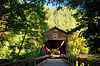 | November 29, 1979 (#79002074) | South of Ruch 42°07′34″N 123°04′19″W / 42.126111°N 123.071944°W / 42.126111; -123.071944 (McKee Bridge) | Ruch | |
| 88 | McKee Bridge Campground | 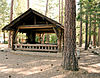 | December 29, 2000 (#00000516) | Upper Applegate Rd. approximately 7 miles (11 km) south of OR 238 42°07′42″N 123°04′14″W / 42.128333°N 123.070556°W / 42.128333; -123.070556 (McKee Bridge Campground) | Jacksonville | |
| 89 | Patrick F. McManus House |  | March 8, 1978 (#78002293) | 117 W. 1st St. 42°16′23″N 122°48′58″W / 42.273114°N 122.816227°W / 42.273114; -122.816227 (Patrick F. McManus House) | Phoenix | |
| 90 | Medford Carnegie Library |  | July 30, 1981 (#81000493) | 413 W. Main St. 42°19′25″N 122°52′36″W / 42.32360556°N 122.8767611°W / 42.32360556; -122.8767611 (Medford Carnegie Library) | Medford | |
| 91 | Medford Central Firehall |  | February 23, 1996 (#96000172) | 110 E. 6th St. 42°19′37″N 122°52′25″W / 42.32693333°N 122.8735222°W / 42.32693333; -122.8735222 (Medford Central Firehall) | Medford | |
| 92 | Medford Downtown Historic District |  | August 14, 1998 (#98000949) | Roughly between Fourth and Ninth Sts., Oakdale and Riverside Aves. 42°19′36″N 122°52′23″W / 42.326667°N 122.873056°W / 42.326667; -122.873056 (Medford Downtown Historic District) | Medford | |
| 93 | Medford Geneva–Minnesota Historic District |  | January 21, 1994 (#93001508) | Geneva and Minnesota Sts., from E. Main to Crater Lake Ave. 42°19′46″N 122°51′49″W / 42.329444°N 122.863611°W / 42.329444; -122.863611 (Medford Geneva–Minnesota Historic District) | Medford | |
| 94 | Medford Grocery Company Warehouse |  | June 20, 2002 (#02000659) | 40 E. 10th St. 42°19′24″N 122°52′15″W / 42.32335278°N 122.8706972°W / 42.32335278; -122.8706972 (Medford Grocery Company Warehouse) | Medford | |
| 95 | Medford IOOF Cemetery |  | March 16, 1989 (#89000205) | Siskiyou Blvd. at Highland Dr. 42°19′16″N 122°51′00″W / 42.321122°N 122.850075°W / 42.321122; -122.850075 (Medford IOOF Cemetery) | Medford | |
| 96 | Medford Plaza Apartments |  | June 16, 2004 (#04000614) | 235 S. Oakdale Ave. 42°19′18″N 122°52′31″W / 42.32160278°N 122.87525°W / 42.32160278; -122.87525 (Medford Plaza Apartments) | Medford | |
| 97 | Medford Southern Pacific Railroad Passenger Depot |  | June 3, 1996 (#96000629) | 147 N. Front St. 42°19′39″N 122°52′29″W / 42.327525°N 122.8747028°W / 42.327525; -122.8747028 (Medford Southern Pacific Railroad Passenger Depot) | Medford | |
| 98 | John W. Merritt House and Store |  | March 9, 1992 (#92000129) | 117 E. Pine St. 42°22′29″N 122°54′57″W / 42.374722°N 122.915833°W / 42.374722; -122.915833 (John W. Merritt House and Store) | Central Point | |
| 99 | Mountain House |  | January 21, 2004 (#03001479) | 1148 Old Highway 99 South 42°07′33″N 122°36′30″W / 42.125833°N 122.608333°W / 42.125833; -122.608333 (Mountain House) | Ashland | |
| 100 | Mountain View Cemetery |  | June 8, 1995 (#95000688) | Junction of Normal Ave. and OR 66 42°11′08″N 122°40′53″W / 42.185556°N 122.681389°W / 42.185556; -122.681389 (Mountain View Cemetery) | Ashland | |
| 101 | Mt. Stella Lookout | Upload image | December 29, 2000 (#00000511) | Approximately 2.5 miles (4.0 km) north of Union Cr. 42°56′15″N 122°26′05″W / 42.937536°N 122.434770°W / 42.937536; -122.434770 (Mt. Stella Lookout) | Prospect | |
| 102 | Amos and Vera Nininger House |  | October 29, 1982 (#82001506) | 80 Hargadine St. 42°11′43″N 122°42′53″W / 42.195404°N 122.714814°W / 42.195404; -122.714814 (Amos and Vera Nininger House) | Ashland | |
| 103 | John Orth House |  | April 11, 1972 (#72001080) | 105 W. Main St. 42°18′48″N 122°58′06″W / 42.313436°N 122.968431°W / 42.313436; -122.968431 (John Orth House) | Jacksonville | |
| 104 | Parker Meadows Shelter | 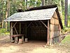 | December 29, 2000 (#00000466) | Near Forest Rd. 37 approximately 15 miles (24 km) northeast of Butte Falls 42°36′04″N 122°19′30″W / 42.601102°N 122.325120°W / 42.601102; -122.325120 (Parker Meadows Shelter) | Butte Falls vicinity | |
| 105 | Reginald Parsons Dead Indian Lodge | 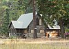 | June 13, 1997 (#97000588) | 4011 Hyatt Prairie Rd. 42°13′34″N 122°24′56″W / 42.226105°N 122.415528°W / 42.226105; -122.415528 (Reginald Parsons Dead Indian Lodge) | Ashland vicinity | |
| 106 | Hamilton and Edith Patton House |  | September 9, 1993 (#93000923) | 245 Valley View Dr. 42°19′57″N 122°50′35″W / 42.332515°N 122.843111°W / 42.332515; -122.843111 (Hamilton and Edith Patton House) | Medford | |
| 107 | S. and Sarah J. Pedigrift House |  | February 20, 1992 (#92000063) | 407 Scenic Ave. 42°12′13″N 122°43′24″W / 42.203734°N 122.723275°W / 42.203734; -122.723275 (S. and Sarah J. Pedigrift House) | Ashland | |
| 108 | Peerless Rooms Building |  | October 8, 1992 (#92001328) | 243–249 Fourth St. 42°11′51″N 122°42′28″W / 42.19753889°N 122.7076833°W / 42.19753889; -122.7076833 (Peerless Rooms Building) | Ashland | Also known as Ganiard Building. |
| 109 | Emil and Alice Applegate Peil House |  | February 20, 1992 (#92000062) | 52 Granite St. 42°11′47″N 122°43′01″W / 42.196440°N 122.717061°W / 42.196440; -122.717061 (Emil and Alice Applegate Peil House) | Ashland | |
| 110 | John and Charlotte Pelton House |  | September 9, 1993 (#93000922) | 228 B St. 42°11′51″N 122°42′41″W / 42.19757778°N 122.7113778°W / 42.19757778; -122.7113778 (John and Charlotte Pelton House) | Ashland | |
| 111 | Domingo Perozzi House |  | February 12, 1980 (#80003320) | 88 Granite St. 42°11′44″N 122°43′03″W / 42.195528°N 122.717513°W / 42.195528; -122.717513 (Domingo Perozzi House) | Ashland | |
| 112 | Dr. E. B. Pickel Rental House |  | October 29, 1982 (#82001507) | 815 W. Main St. 42°19′25″N 122°52′52″W / 42.32351944°N 122.8811583°W / 42.32351944; -122.8811583 (Dr. E. B. Pickel Rental House) | Medford | |
| 113 | Humboldt Pracht House |  | December 23, 1981 (#81000489) | 234 Vista St. 42°11′39″N 122°42′49″W / 42.194031°N 122.713670°W / 42.194031; -122.713670 (Humboldt Pracht House) | Ashland | |
| 114 | Prospect Hotel |  | February 12, 1980 (#80003327) | 39 Mill Creek Dr. 42°45′04″N 122°29′12″W / 42.751111°N 122.486667°W / 42.751111; -122.486667 (Prospect Hotel) | Prospect | Also known by historic name A.H. Boothby House. |
| 115 | Putnam–Neff House |  | April 25, 2008 (#08000337) | 227 N. Berkeley Wy. 42°19′51″N 122°51′01″W / 42.33088889°N 122.8502556°W / 42.33088889; -122.8502556 (Putnam–Neff House) | Medford | |
| 116 | Alfred Evan Reames House |  | February 20, 1991 (#91000049) | 816 W. 10th St. 42°19′17″N 122°52′48″W / 42.32144167°N 122.8800944°W / 42.32144167; -122.8800944 (Alfred Evan Reames House) | Medford | |
| 117 | Dr. John F. and Mary Reddy House |  | September 10, 1987 (#87001538) | 122 Oregon Terr. 42°19′49″N 122°51′11″W / 42.330278°N 122.853056°W / 42.330278; -122.853056 (Dr. John F. and Mary Reddy House) | Medford | |
| 118 | Rich Gulch Diggings |  | March 23, 2000 (#00000288) | 0.75 miles (1.21 km) southwest of Jacksonville 42°18′33″N 122°58′46″W / 42.309167°N 122.979444°W / 42.309167; -122.979444 (Rich Gulch Diggings) | Jacksonville | |
| 119 | Rock Point Hotel |  | September 4, 1980 (#80003322) | 40 N. River Rd. 42°25′59″N 123°05′30″W / 42.433142°N 123.091710°W / 42.433142; -123.091710 (Rock Point Hotel) | Gold Hill | |
| 120 | Rogue Elk Hotel |  | February 22, 1980 (#80003329) | 27390 OR 62 42°39′44″N 122°45′25″W / 42.662222°N 122.756944°W / 42.662222; -122.756944 (Rogue Elk Hotel) | Trail | |
| 121 | Root–Banks House |  | August 5, 1994 (#94000807) | 11 N. Peach St. 42°19′26″N 122°52′58″W / 42.32397222°N 122.882725°W / 42.32397222; -122.882725 (Root–Banks House) | Medford | |
| 122 | Fordyce Roper House – Southern Oregon Hospital |  | December 2, 1985 (#85003075) | 35 S. Second St. 42°11′41″N 122°42′44″W / 42.194819°N 122.712134°W / 42.194819; -122.712134 (Fordyce Roper House – Southern Oregon Hospital) | Ashland | |
| 123 | Schuler Apartment Building |  | June 19, 1991 (#91000800) | 38 N. Oakdale Ave. 42°19′28″N 122°52′41″W / 42.32443611°N 122.8780722°W / 42.32443611; -122.8780722 (Schuler Apartment Building) | Medford | |
| 124 | Shone–Charley House |  | October 25, 1984 (#84000131) | 305 N. Grape St. 42°19′39″N 122°52′40″W / 42.32753056°N 122.8777639°W / 42.32753056; -122.8777639 (Shone–Charley House) | Medford | |
| 125 | Col. William H. Silsby House |  | February 28, 1985 (#85000365) | 111 3rd St. 42°11′47″N 122°42′35″W / 42.19626111°N 122.7096278°W / 42.19626111; -122.7096278 (Col. William H. Silsby House) | Ashland | |
| 126 | Siskiyou–Hargadine Historic District |  | September 14, 2002 (#02001008) | Roughly bounded by East Main, Morse, Beach, Iowa, and Pioneer Sts. 42°11′30″N 122°42′25″W / 42.191667°N 122.706944°W / 42.191667; -122.706944 (Siskiyou–Hargadine Historic District) | Ashland | |
| 127 | Skidmore Academy Historic District | | August 14, 2001 (#01000832) | Roughly bounded by the railroad right-of-way, Granite, Scenic, and Maple Sts. 42°11′59″N 122°43′04″W / 42.199722°N 122.717778°W / 42.199722; -122.717778 (Skidmore Academy Historic District) | Ashland | |
| 128 | Snowy Butte Flour Mill |  | September 1, 1976 (#76001581) | 402 N. Royal Avenue 42°28′27″N 122°47′54″W / 42.474175°N 122.798280°W / 42.474175; -122.798280 (Snowy Butte Flour Mill) | Eagle Point | Damaged severely by fire, Christmas Day 2015.[10] The Butte Creek Foundation is nearing completion of a historically-based restoration that will return the mill to operation, with the original Buhr stones and gearing, in 2020. |
| 129 | South Oakdale Historic District |  | March 15, 1979 (#79002072) | Irregular pattern along S. Oakdale Ave. from Stewart Ave. to W. 10th St. 42°18′58″N 122°52′28″W / 42.316212°N 122.874438°W / 42.316212; -122.874438 (South Oakdale Historic District) | Medford | Development of this well-preserved residential neighborhood began in 1890 and continued until around 1940. It became one of the city's grand neighborhoods, with many residents prominent in Medford. The district exhibits a wide range of architectural styles, notably including several works by Frank Chamberlain Clark.[11] |
| 130 | Sparta Building |  | October 8, 1992 (#92001329) | 12 N. Riverside Ave. 42°19′40″N 122°52′14″W / 42.32766944°N 122.8704861°W / 42.32766944; -122.8704861 (Sparta Building) | Medford | |
| 131 | Squaw Peak Lookout |  | December 29, 2000 (#00000512) | Approximately 8 miles (13 km) south of FS Rd. 20, 25 miles (40 km) south of Jacksonville 42°04′10″N 123°00′40″W / 42.069444°N 123.011111°W / 42.069444; -123.011111 (Squaw Peak Lookout) | Jacksonville vicinity | |
| 132 | Star Ranger Station |  | March 6, 1991 (#91000168) | East of Applegate R., Rogue R. NF 42°09′02″N 123°03′31″W / 42.150556°N 123.058611°W / 42.150556; -123.058611 (Star Ranger Station) | Ruch | |
| 133 | Star Ranger Station Building, Old |  | December 29, 2000 (#00000460) | 6941 Upper Applegate Rd. 42°09′01″N 123°03′29″W / 42.150278°N 123.058056°W / 42.150278; -123.058056 (Star Ranger Station Building, Old) | Jacksonville | |
| 134 | Dr. Charles T. and Mary Sweeney House |  | June 4, 1992 (#92000664) | 2336 Table Rock Rd. 42°21′09″N 122°53′02″W / 42.3525°N 122.883889°W / 42.3525; -122.883889 (Dr. Charles T. and Mary Sweeney House) | Medford | |
| 135 | Talent Elementary School |  | March 7, 2012 (#12000080) | 206 Main Street 42°14′41″N 122°47′18″W / 42.244799°N 122.788434°W / 42.244799; -122.788434 (Talent Elementary School) | Talent | |
| 136 | George Taverner House |  | November 7, 1978 (#78002290) | 912 Siskiyou Blvd. 42°11′20″N 122°41′58″W / 42.188889°N 122.699444°W / 42.188889; -122.699444 (George Taverner House) | Ashland | |
| 137 | Tayler–Phipps Building |  | February 23, 1990 (#90000280) | 221–225 E. Main St. 42°19′37″N 122°52′19″W / 42.32699444°N 122.8718417°W / 42.32699444; -122.8718417 (Tayler–Phipps Building) | Medford | |
| 138 | Trinity Episcopal Church |  | April 5, 1984 (#84003015) | 44 N. 2nd St. 42°11′45″N 122°42′38″W / 42.19570833°N 122.710625°W / 42.19570833; -122.710625 (Trinity Episcopal Church) | Ashland | |
| 139 | U.S. Post Office and Courthouse |  | April 30, 1979 (#79002073) | 310 W. 6th St. 42°19′32″N 122°52′38″W / 42.32546944°N 122.8771472°W / 42.32546944; -122.8771472 (U.S. Post Office and Courthouse) | Medford | |
| 140 | Union Creek Historic District |  | October 29, 1980 (#80003328) | Oregon Route 62 42°54′26″N 122°26′41″W / 42.907196°N 122.444643°W / 42.907196; -122.444643 (Union Creek Historic District) | Prospect vicinity | |
| 141 | Henry Van Hoevenberg Jr. House |  | December 10, 1981 (#81000491) | 9130 Ramsey Canyon Rd. 42°30′19″N 122°59′41″W / 42.505156°N 122.994861°W / 42.505156; -122.994861 (Henry Van Hoevenberg Jr. House) | Gold Hill | |
| 142 | Wagner Creek School |  | October 8, 1992 (#92001331) | 8448 Wagner Creek Rd. 42°12′44″N 122°47′31″W / 42.212291°N 122.791879°W / 42.212291; -122.791879 (Wagner Creek School) | Talent | |
| 143 | John P. Walker House |  | March 14, 1978 (#78002291) | 1521 E. Main St. 42°11′45″N 122°41′22″W / 42.195787°N 122.689429°W / 42.195787; -122.689429 (John P. Walker House) | Ashland | |
| 144 | Washington Elementary School | 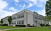 | October 31, 2012 (#12000899) | 610 S. Peach St. 42°19′02″N 122°52′58″W / 42.317257°N 122.882715°W / 42.317257; -122.882715 (Washington Elementary School) | Medford | |
| 145 | Mathias Welch House |  | June 4, 1998 (#98000625) | 162 N. Second St. 42°22′35″N 122°54′59″W / 42.376389°N 122.916389°W / 42.376389; -122.916389 (Mathias Welch House) | Central Point | |
| 146 | West Side Feed and Sale Stable |  | December 21, 1981 (#81000494) | 29 S. Grape St. 42°19′29″N 122°52′28″W / 42.32466111°N 122.8744361°W / 42.32466111; -122.8744361 (West Side Feed and Sale Stable) | Medford | |
| 147 | John B. White House |  | November 2, 1978 (#78002294) | 86 N. River Rd. 42°25′59″N 123°05′32″W / 42.433068°N 123.092131°W / 42.433068; -123.092131 (John B. White House) | Gold Hill | |
| 148 | Harry L. Whited House |  | June 3, 1998 (#98000626) | 321 N. Main St. 42°12′09″N 122°43′11″W / 42.202484°N 122.719716°W / 42.202484; -122.719716 (Harry L. Whited House) | Ashland | |
| 149 | Whittle Garage Building |  | March 7, 1997 (#97000142) | 101 Oak St. 42°11′51″N 122°42′52″W / 42.1976°N 122.7144778°W / 42.1976; -122.7144778 (Whittle Garage Building) | Ashland | |
| 150 | Wilkinson–Swem Building |  | August 26, 1982 (#82003727) | 217 E. Main St. 42°19′37″N 122°52′19″W / 42.32693611°N 122.87195°W / 42.32693611; -122.87195 (Wilkinson–Swem Building) | Medford | |
| 151 | Willow Prairie Cabin |  | December 29, 2000 (#00000469) | FS Rd. 37 approximately 1.5 miles (2.4 km) north of Butte Falls 42°24′23″N 122°23′30″W / 42.406389°N 122.391667°W / 42.406389; -122.391667 (Willow Prairie Cabin) | Butte Falls | |
| 152 | Women's Civic Improvement Clubhouse |  | June 16, 1989 (#89000513) | 59 Winburn Way 42°11′45″N 122°43′00″W / 42.195904°N 122.716746°W / 42.195904; -122.716746 (Women's Civic Improvement Clubhouse) | Ashland | |
| 153 | Isaac Woolen House | 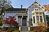 | October 16, 1979 (#79002067) | 131 N. Main St. 42°11′58″N 122°43′02″W / 42.199369°N 122.717282°W / 42.199369; -122.717282 (Isaac Woolen House) | Ashland | |
| 154 | Wrangle Gap Shelter |  | December 29, 2000 (#00000505) | FS Rd. 20 approximately 25 miles (40 km) southwest of Ashland 42°03′02″N 122°51′18″W / 42.050556°N 122.855°W / 42.050556; -122.855 (Wrangle Gap Shelter) | Ashland |
Former listings
| [5] | Name on the Register | Image | Date listed | Date removed | Location | City or town | Description |
|---|---|---|---|---|---|---|---|
| 1 | David N. Birdseye House |  | May 1, 1974 (#74001688) | August 5, 1991 | U.S. 99, S of Rogue River | Rogue River vicinity | Destroyed by fire in 1990.[12] Rebuilt using original plans and construction methods. |
| 2 | Cargill Court Apartments | Upload image | June 14, 1990 (#90000836) | January 10, 1994 | 331 W 6th St. | Medford | |
| 3 | Samuel Colver House | Upload image | October 25, 1990 (#90001596) | April 15, 2009 | 150 Main St. 42°16′17″N 122°48′42″W / 42.2714°N 122.8117°W / 42.2714; -122.8117 (Samuel Colver House) | Phoenix | Home of settler Samuel Colver. A fire destroyed the building on September 15, 2008.[13][14] |
| 4 | Conro Fiero House |  | December 9, 1981 (#81000490) | June 1, 2011 | 4615 Hamrick Road 42°23′01″N 122°53′34″W / 42.3836°N 122.8928°W / 42.3836; -122.8928 (Conro Fiero House) | Central Point | Known as the Mon Desir restaurant when destroyed by fire January 10, 2010[15] |
| 5 | Medford Hotel |  | June 6, 1985 (#85001180) | December 5, 1988 | 406 W. Main St. | Medford | Destroyed by fire August 8, 1988.[16][17] |
| 6 | Wimer Bridge |  | November 29, 1979 (#79002075) | April 18, 2006 | E. Evans Creek Rd 42°32′17″N 123°08′59″W / 42.538169°N 123.149828°W / 42.538169; -123.149828 (Wimer Bridge) | Wimer | The first bridge over Evans Creek in Wimer was built at this location in 1892, then replaced with a new covered bridge in 1927. The 1927 bridge collapsed in 2003 due to traffic load.[18] A third, replica bridge was built in 2008.[19][20] |
See also
 Oregon portal
 National Register of Historic Places portal


- National Register of Historic Places listings in Oregon
- Listings in neighboring counties: Douglas, Josephine, Klamath, Siskiyou
- List of National Historic Landmarks in Oregon
- Historic preservation
- History of Oregon
- Lists of Oregon-related topics
References
- ^ Andrus, Patrick W.; Shrimpton, Rebecca H.; et al. (2002), How to Apply the National Register Criteria for Evaluation, National Register Bulletin, National Park Service, U.S. Department of the Interior, OCLC 39493977, archived from the original on April 6, 2014, retrieved June 20, 2014.
- ^ National Park Service, National Register of Historic Places Program: Research, archived from the original on February 1, 2015, retrieved January 28, 2015.
- ^ Oregon Parks and Recreation Department, Oregon Historic Sites Database, retrieved August 6, 2015. Note that a simple count of National Register records in this database returns a slightly higher total than actual listings, due to duplicate records. A close reading of detailed query results is necessary to arrive at the precise count.
- ^ National Park Service, United States Department of the Interior, "National Register of Historic Places: Weekly List Actions", retrieved August 16, 2024.
- ^ a b Numbers represent an alphabetical ordering by significant words. Various colorings, defined here, differentiate National Historic Landmarks and historic districts from other NRHP buildings, structures, sites or objects.
- ^ The eight-digit number below each date is the number assigned to each location in the National Register Information System database, which can be viewed by clicking the number.
- ^ a b Federal and state laws and practices restrict general public access to information regarding the specific location of this resource. In some cases, this is to protect archeological sites from vandalism, while in other cases it is restricted at the request of the owner. See: Knoerl, John; Miller, Diane; Shrimpton, Rebecca H. (1990), Guidelines for Restricting Information about Historic and Prehistoric Resources, National Register Bulletin, National Park Service, U.S. Department of the Interior, OCLC 20706997.
- ^ Kramer, George (August 1, 1996), National Register of Historic Places Registration Form: Egan, H. Chandler and Alice B., House (PDF), retrieved September 1, 2014.
- ^ McKithan, Cecil (September 12, 1977), National Register of Historic Places Invenory — Nomination Form: Jacksonville Historic District (PDF), retrieved September 22, 2013.
- ^ The Oregonian staff (December 27, 2015), "Christmas fire destroys Jackson County's 143-year-old Butte Creek Mill", OregonLive.com, Portland, archived from the original on February 25, 2016, retrieved February 25, 2016.
- ^ Bryden, Vicki Anne (August 1978), National Register of Historic Places Inventory — Nomination Form: South Oakdale Historic District (PDF), retrieved December 13, 2013.
- ^ "Historic home burns". Corvallis Gazette-Times. November 25, 1990. p. 4. Retrieved August 18, 2022 – via Newspapers.com.
- ^ "Former mayor, wife hurt in Phoenix fire". Statesman Journal. September 16, 2008. p. 5C. Retrieved August 18, 2022 – via Newspapers.com.
- ^ Achen, Paris (September 15, 2008). "Fire destroys Colver House". Mail Tribune. Medford, Oregon. Archived from the original on June 10, 2011. Retrieved June 15, 2011.
- ^ Burke, Anita (October 16, 2010). "Fiery end to Mon Desir". Mail Tribune. Medford, Oregon. Retrieved June 15, 2011.
- ^ "Medford hotel burns on the verge of new life". Corvallis Gazette-Times. August 10, 1988. p. B3. Retrieved August 18, 2022 – via Newspapers.com.
- ^ "Torch was the culprit in 1988 hotel fire". Archived from the original on 2016-09-18. Retrieved 2016-08-04.
- ^ "Weak beam cited at bridge". Corvallis Gazette-Times. July 8, 2003. p. A3. Retrieved August 18, 2022 – via Newspapers.com.
- ^ Oregon Department of Transportation (July 25, 2003), Evans Creek (Wimer) Covered Bridge (PDF), retrieved August 7, 2015.
- ^ The Associated Press (July 7, 2008), "New Wimer covered bridge dedicated", The Oregonian, Portland, retrieved August 7, 2015.
External links
Map all coordinates using OpenStreetMap
Download coordinates as:
- KML
- GPX (all coordinates)
- GPX (primary coordinates)
- GPX (secondary coordinates)
- Oregon Parks and Recreation Department, National Register Program
- National Park Service, National Register of Historic Places site
 Media related to National Register of Historic Places in Jackson County, Oregon at Wikimedia Commons
- v
- t
- e
by county

- National Historic Landmarks
- Bridges and Tunnels
- National Historic Sites
- National Monuments
| |
|---|---|
| Topics | |
| Lists by state |
|
| Lists by insular areas | |
| Lists by associated state | |
| Other areas | |
| Related | |
| |

Municipalities and communities of Jackson County, Oregon, United States | ||
|---|---|---|
County seat: Medford | ||
| Cities |  | |
| CDPs | ||
| Other unincorporated communities | ||
| Ghost towns | ||
| ||


